
|
The Welney WebsiteWelney Wash Road floodingReport first posted Feb 2007; last updated Wednesday, 19 February 2020 |
|
|
|
||
|
|
IntroductionThe Ouse Washes are part of a flood defence system. They are an unihabited area of nearly six thousand acres that provides storage for floodwater that the River Great Ouse cannot discharge directly into the sea (at Kings Lynn) without overflowing its banks. The excess waters are held within the washes until tides and river flows allow discharge back into the river and thence the sea. This can take a few days or a several weeks.Unfortunately, this essential safety feature results in regular flooding of a section of the A1101 main road where it crosses the washes between Welney and Suspension Bridge. This part of the road is known as the Wash Road or Welney Wash Road, but referred to as Welney Causeway by the Environment Agency (EA), the authority responsibe for flood protection and drainage. |
You may need to refresh this page to see the ltest version
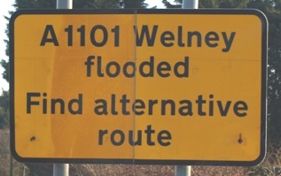
Sign at top of page
at Christchurch/Tipps End. Most signs do state alternative routes. (photo: webmaster) |
|
A1101 Wash Road flood status
Check EA water level information: (1) online at Welney Causeway It is now generally accepted that the Wash Rd starts to flood at 2.40m and the level gauge in the river (see photos below) has a red line at 2.40 AOD. (2) by phone on the EA 'Flood-Line' 0845 988 1188 choose option 1 then key in 'quick-dial number' 03363. You do not have to hear the full recorded announcements, as soon as the first one starts press 1, and when the second begins tap in the quick dial number. Note: the information is usually updated daily and correct only at the time stated. Depths can vary up or down after that. The EA refer to the Wash Road as "Welney Causeway". (3) Read the level gauge at Welney see photos below. The readings indcate the level of the water in the washes "Above Ordnance Datum" (AOD). It is simple to convert the reading to depth of water on the road - when you know how - see below. |
Flooding of the road starts when the water level at Welney reaches 2.40m OD. Deducting that figure from the
current level displayed here gives depth of water on the road. Other ways of finding information are shown in the left column. And from spring 2014, roadside LED warning signs have begun to be displayed around the area which indicate current flood depth. Flooding causes major disruption and additional expense to hundreds of private motorists, local delivery services and transport companies, and severely affects the profitability of some local businesses. Those affected therefore expect the EA to restrict the flooding of the Wash Road to as short a duration as possible and provide accurate information. To compound the problems, two other authorities, Norfolk County Council (NCC) and Cambridgeshire County Council (CCC) are responsible for displaying warning signs on roads and approach routes in their respective areas when the EA advise them flooding is about to begin; in Cambridgeshire, that is further spilt between two highways dept divisions. The crude metal "flap" signs merely state that the road is flooded (or not) but give no indication of water depth. Most signs suggest alternative routes. NCC are also responsible for closing the half-gates at each end. All to frequently the signs are displayed and gates closed when the water is little more than a shallow puddle, even totally dry, a most unsatifactory system that has led many regular users of the road to ignore the signs. The photos below show another problem - the EA and NCC give conflicting information at Welney as to the depth of water. March 5th 2011. Looking east from the Delph Bridge. The water flows right to left. 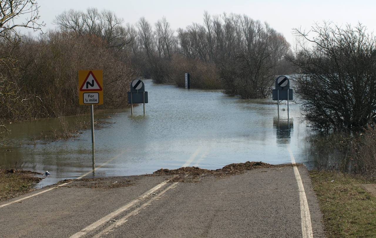 The three photos above were taken by the webmaster within minutes of each other. On the left, the EA's level gauge in the Delph. On the right a close up of the NCC highways dept road-side depth board seen in the distance in the centre photo. The readings differ significantly. |
Below warning signs and "barrier" in 2006
(photo courtesy Mark Farrow) 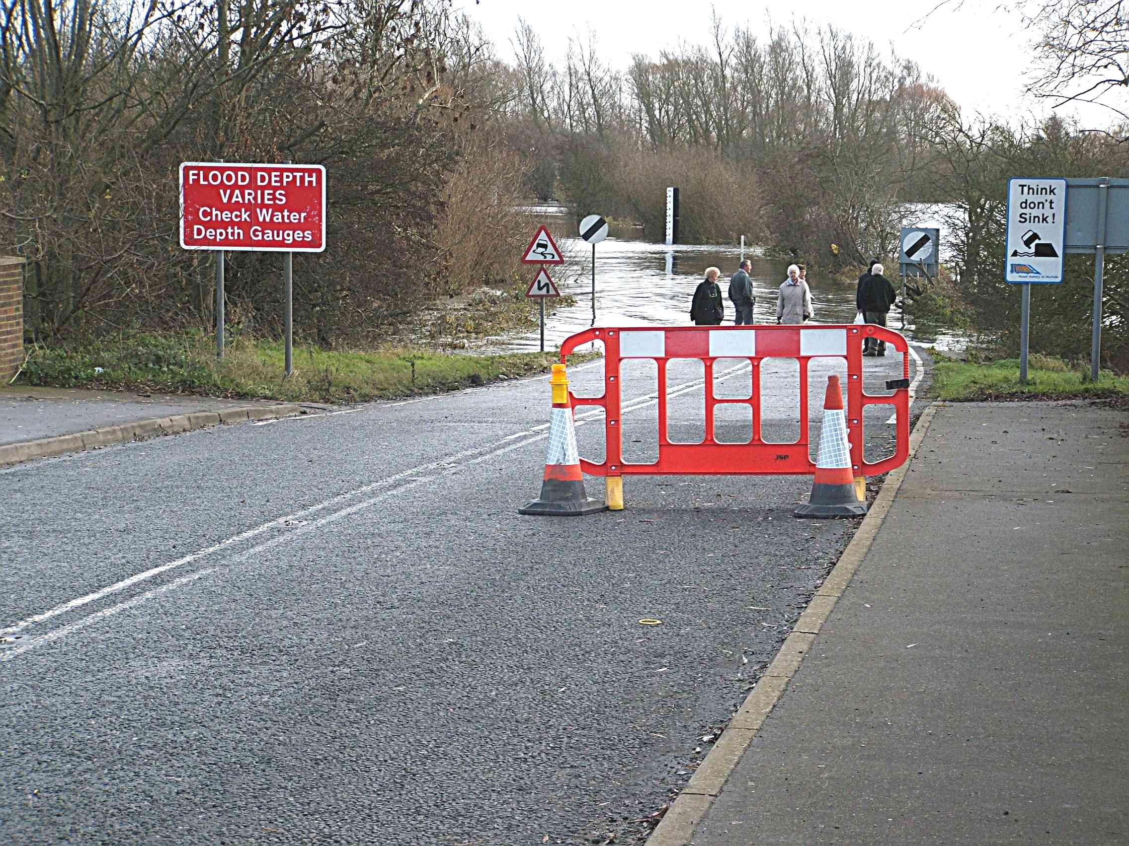
The signs are not very helpful and the barrier totally innefective. Half-gates replaced plastic barriers in 2009 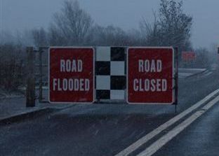 but are they any more effective ? (photo by Webmaster)
March 5th 2011. Level gauge in Delph
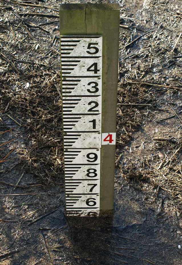 This board on the west bank of the Delph, just south of the bridge, reads 3.54m. Note the previous day's level of 3.58 is still visible. The EA webpage (above) says that is the highest "in recent years" The figure at which water begins to trickle over the road from the south (right side on centre photo) is apparently 2.4m AOD shown by a red line on the level gauge 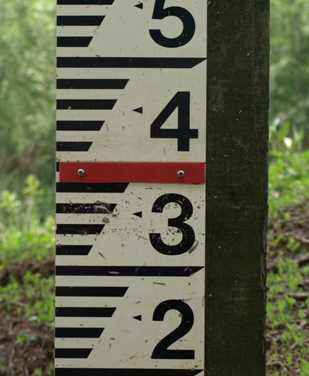
click for super-close up This figure is agreed as accurate by many locals. However, the EA "OB LEAP" report in 1997 stated 2.35m. |
|
Deepest floods
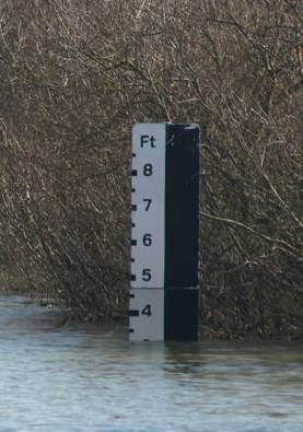
On 14th March 1937 the flood depth was recorded as 6ft 4ins. Residents of properties along the Bedford Banks were advised of possible evacuation, and a military contingent was billeted in the school in case of emergency. (Source: Tony Smart) The EA's website says the highest recorded river level is 4.17m - equivalent to a depth of 6ft 10ins on the road. |
The EA's gauge cannot be seen from the road; it shows only the level of water in the washes "above ordnance datum" and doesn't tell how to convert the readings to flood depth on road; and the "helpful" red mark is not explained and in any case isn't visible when the road is flooded. "Locals" and readers of this page can however calculate the depth on road is around 1.14m to 1.19m (i.e. 3.54 less 2.35 or 2.40 as explained on left) which is 3ft 9ins to 3ft 11ins. The highways department's depth boards on the road side, which drivers are urged to check, shows a figure around 3ft 2in, 8 inches less! Whichever figure is correct (and we suggest that is the EA figure), beware. The road dips in places, particularly on the north side of a bend near Suspension Bridge where depth will be a couple of inches more than calculated above; and wind-driven waves and traffic bow waves can add several more inches. Welney Parish Council (WPC) has sought to resolve the flooding problem for many years. In 1993, for instance, WPC set up a working party, used local newspapers to publicise the problems and held open meetings in the Parish Hall attracting so many people some had to stand outside (including on one occasion the current webmaster). They enlisted the help of the then local MP, Mrs Gillian Shephard, and maintained pressure on the EA and NCC for several years, in particular with regard to raising the roadway in some way. That resulted in an NCC report in 1996 (not seen by the Webmaster) detailing various options for doing so. Funding schemes were investigated, including one from the EU, but no money was available and the options could not be progressed. NCC had further discussions with EA occasionally for several years but by 1999 it was obvious that the EA would not agree to raising the road (or even kerbing it?) because of, amongst others, the SSSI status of the washes. |
March 5th 2011. Road-side board
 Above is a close up of the board shown in the centre of the photo on left. It indicates a depth ahead of about 3ft 2ins. Locally these boards are considered very inaccurate, under-reading the depth by many inches, borne out by the photographic evidence on this page - see centre column. Yet it is these gauges that NCC tells motorists to use! Originally the boards also showed metric figures but they were blacked out by anti metric protesters - see ARM website 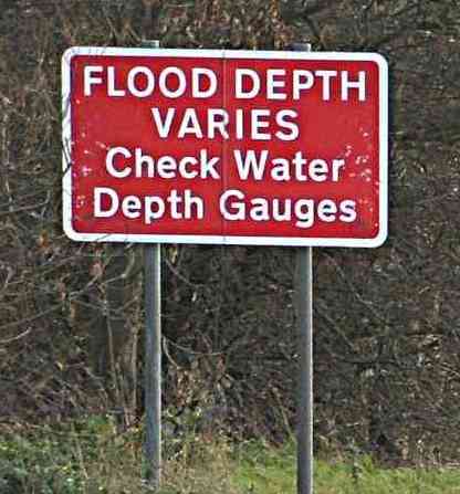 |
|
|
At the Annual Parish Meeting held in Welney In March 2001 two representatives of NCC were invited to speak "on highway
strategy". Both said the proposal by Cllr Green, Chair of WPC,
to kerb 340m on low spots on the road (to reduce the days the
road was flooded) "had been considered at length and it had been
agreed that the work should go ahead". Yet only a few months
later, in Sept 2001, an NCC report stated "[recent] studies
have shown .... raising the kerbing at low spots .......... is
impracticable because of soil conditions adjacent to the
causeway". Discussions with NCC, CCC and several local Parish Councils did however result in proposals for improvements in the wording of signs. Despite prolonged flooding of the road in 2002, it wasn't until the winter floods of 2006-2007 that much more was attempted by WPC to improve matters. The road was flooded for the most prolonged period for years, from the end of November 2006 to March 2007 with only a few dry periods in between, creating an enormous furore locally and wider afield. Local opinion was that the EA failed to maintain some waterways allowing silt to build up and prevent sluices from operating properly, and consequently not allowing flood water to be discharged to the sea, an allegation the EA strongly denied. This got WPC going again and they sought assistance from our MP and local newspapers just as their predecessors had 14 years before. As a result, Christopher Fraser, MP, raised the matter in the House of Commons. You can read read his question and the government's response using the link below. |
|
|
Acknowledgements.
General text © Peter Cox, 2006-20 If you think this report is incorrect, incomplete or unfair, please e-mail the webmaster, and your response will be added. |
Since then, WPC have had many discussions with
the EA and other organisations and initiated
meetings with adjoining parish councils, but
most people now accept there will be no solution to the floods in the
forseeable future. However, residents and other road users say vastly improved information and signs could and should be provided. WPC have requested continuously-updated electronic signs indicating water depth, but without sucess; the minutes of the March 2011 meeting of WPC stated "...dot matrix signs are not on the cards at all at the present, because of financial restrictions." More optimistically, the minutes also recorded that "It is hoped that the levelling work on the Wash Road will be carried out fairly soon". The EA have had a sophisticated sensing infrastructure in place for many years and technology is cheaply available to display that data on solar-powered roadside screens, yet the highways authorities will have to continue to send staff out in vans to climb up ladders to open or close flaps on crude metal signs, and motorists will still have to make long detours often unnecessarily, or drive to Welney to have a look themselves to see if the road is passable or not. |
|
| any comments? please e-mail webmaster | ||