
The Welney Website
Pates Farm Archaeological Report
page created 18th August 2011, amended/updated Saturday, 18 October 2014
The farm has been the home of the Goodger family since 1998 and is the base for their farming operations.
In 2008 Anglian Water proposed building a sewage reservoir in a field about 500m west of the farmyard. Prior to the works an archaeological investigation of the site was conducted as part of the planned development and the following is the summary of the subsequent report:
"An archaeological evaluation found the remains of part of a post-medieval pasture field system probably dating to the 17th or 18th century and was likely to have been a pre-enclosure field system. Within the development area, there were two north-south ditches 100m apart, one of these was dated by artefacts to at least the 17th or 18th century. There was evidence of stake holes along the base of both ditch lines showing that the fields were enclosed. It was likely that these fences were for cattle farming for grazing in the dryer summer months. There were a few other undated ephemeral features within the evaluation area but it was likely most of these were of natural origin. The present field boundaries of the development area cut this former field system. The new boundaries were probably established as part of the18th century enclosing of the fens. The area was also affected by the various Parliamentary Acts to drain and improve the area in the 18th and 19th centuries. This process meant that arable farming took over as the main farming use in fen lands."
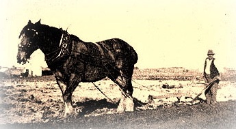
"In the pre-enclosure period, cattle was often grazed during summer on marginal land, fattened up and slaughtered in autumn and the land left fallow during winter. Marginal land only became fit for arable in the 18th century onwards with steam engines used to drain land and later for steam ploughing. Land plots became relatively small and were surrounded by deep drainage ditches. Due to this activity and the various Parliament Acts for drainage land improvement it caused arable farming to be the predominant farming land use in the fenland area.
The present field boundaries has not changed for at least 120 years. The 1889 1st Edition Ordnance Survey Map (1: 10 560) shows the same boundaries as today. These field boundaries cut the north to south ditches shown on the cropmarks (Fig 3). The surrounding fields in the 1st Ordnance Survey map are all relatively small with deep drainage ditches around them."
|
Acknowledgements. Report by Rob Atkins of Oxford Archaeology East (commissioned by Anglian Water) |